Difference between revisions of "Kyle and Carrick"
(Created page with "{{coord|55.426|-4.603|display=title|region:GB_scale:50000}} {{Unreferenced|date=December 2009}} right '''Kyle and Carrick''' ('''''A' Chùil...") |
m (1 revision) |
(No difference)
| |
Latest revision as of 07:42, 1 November 2015
Coordinates: 55°25′34″N 4°36′11″W / 55.426°N 4.603°W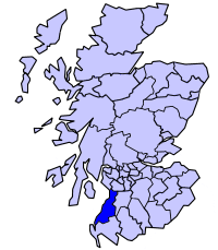
Fatal error: The format of the coordinate could not be determined. Parsing failed.

Kyle and Carrick (A' Chùil agus a' Charraig in Scottish Gaelic) was one of nineteen local government districts in the Strathclyde region of Scotland from 1975 to 1996.
The district was formed by the Local Government (Scotland) Act 1973 from part of the former county of Ayrshire, namely:
- The burghs of Ayr, Girvan, Maybole, Prestwick and Troon
- The districts of Girvan and Maybole
- The district of Ayr (except the part in Irvine New Town)
- Part of Dalmellington district
The district council's headquarters were in Ayr.
The district was abolished in 1996 by the Local Government etc. (Scotland) Act 1994 which replaced regions and districts with unitary council areas. South Ayrshire council area was formed with identical boundaries to Kyle and Carrick District.